


Gps Coordinates / 46.1913925,-122.195889
Volcano Mount St Helens USA Map VR
Cougar, WA 98616, United States
Mount St. Helens Volcano caused a severe eruption in 1980. It is said to be one of the worst eruptions in the history of USA. Another eruption of the history was recorded on May 18, 1980, showing 5.1 on the Richter scale.
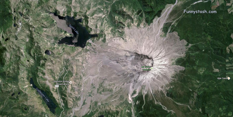
Aerial View Of Volcano Mount St Helens USA
At the top of what's left of the summit, volcano was ripped in half during the largest explosion in 50 years

Link Location Gps -122.1958114
Gps Coordinates / 46.1903882,-122.1958114
Watch this video to watch St Helens explode


