Gps Coordinates / 24.9347839,104.3806976
Canola Flower Fields Luoping China Scenery 360 Area Places
Y013, Luoping Xian, Qujing Shi, Yunnan Sheng, China
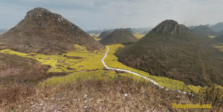
Luoping County is quiet for most of the year until the canola flowers bloom, and then the area of Yunnan, China, is reborn into a vibrant natural spectacle of yellow flowers as far as the eye can see.
GPS Coordinate Directions / 24.9442768,104.3923798
The fields of canola — also known as rapeseed — are used in the production of cooking oil. They’re also as popular with bees as tourists and photographers, so beekeepers set up tents among the flowers during their February to March bloom. While most anywhere outside the limits of the small town of Luoping is drenched in the sunny hues, the most surreal places to view them are with the towering mountains like the Golden Rooster Hill (aka Jinjifeng) and Hundred Thousand Hills spiking up from the floral fields. In some areas they also form otherworldly shapes in the terraced farms.
Gps Coordinates / 24.946373,104.3919296
At the beginning of the canola season an annual festival is held in the flower’s honor, while after the petals fall Luoping County returns to its slumber amongst the hills.
Aerial View of the Canola Flower Fields from above in these VR Map Locations
Aerial View Canola Flower Fields Luoping China Scenery


