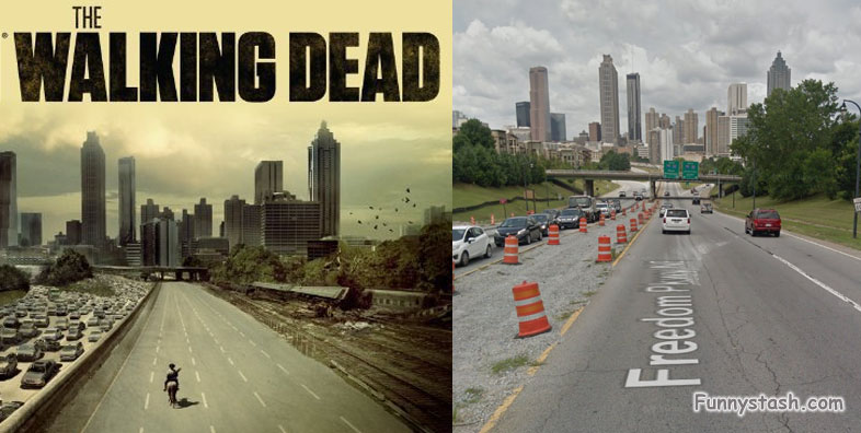
Gps Coordinates / 33.7602575,-84.3725182
The Walking Dead Vr Map Locations
433 Highland Ave NE, Atlanta, GA 30312, USA
The CDC building
Season 1 finale see’s the center for disease control “CDC Building” turn to disaster and their only hope left to turn this disease around and save humanity doesn’t go quite to plan
GPS coordinates / 33.884306, -84.459143
Town of the governor
Governors Town season 3. This entire town is a treasure trove for Walking dead fans, alot of the show was filmed locally and the entire crew lived close by here during filming, everything looks familiar even restricted areas such as Hershels farm and the Prison is here, the farm is closed off and the Prison is a real detention center so it’s closed off, you can see it on a google maps aerial view i suppose but it’s just teasingly close to taunt you with it, apparently during season 3 the cast lived remotely around the farm
Terminus
Terminus from Season 4 and 5 when the gang finally find their salvation or as usual so it would appear, a whole new deadly host of problems arise where the gang need to find their way out of their new perils. Google Car goes all around the terminus even going as far as the dirt roads at the back of the building and way long before this location was even scouted for filming or before Google even purchased keyhole and renamed it to Maps
GPS coordinates / 33.731220, -84.397494
Terminus Backyard
A Complete passing by during the set development, kinda special if your into that sorta thing, as you can see the container Grimes and his crew were thrown into after surrendering their weapons to be later tortured for information is visible in this view. Even the no-trespassing signs are up, if only Grimes would have thought of that earlier all of these problems could have been avoided
Our VR Map showcase instructional of The Walking Dead ↓
