GPS Coordinates / -9.0971388,149.2791581
Papua New Guinea Tourism VR Map Links
W73H+4MV Amuioan, Papua New Guinea
At the national level, after being ruled by three external powers since 1884, Papua New Guinea established its sovereignty in 1975. This followed nearly 60 years of Australian administration, which started during World War I. It became an independent Commonwealth realm in 1975 with Elizabeth II as its queen. It also became a member of the Commonwealth of Nations in its own right.
Kids sitting on old Japanese WWII Cannons

GPS Coordinates / -3.585437, 143.632887
As of 2019, it is also the most rural, as only 13.25% of its people live in urban centres.


Link Location Gps / Gps Link -8.682492 / Gps Link -10.611014 / Gps Link -9.360192
Gps Coordinates / -8.682492,148.417875 / -10.611014,150.661150 / -9.360192,147.497689
There could be weapons buried all over here and enough TnT to blow up the surrounding jungle by a large vicinity at the Eora Creek is unearthed within this Panorama 360 below
-
Eora Creek starts at central ridge of Owen Stanley Mountains and runs northwards Mambare River east of Kokoda

GPS Coordinates / -9.033425,147.739444
Also in 1884, the southern part of the country became a British protectorate. In 1888 it was annexed, together with some adjacent islands, by Britain as British New Guinea. In 1902, Papua was effectively transferred to the authority of the new British dominion of Australia. With the passage of the Papua Act 1905, the area was officially renamed the Territory of Papua, and Australian administration became formal in 1906.
Most of the population of more than 8,000,000 people live in customary communities, which are as diverse as the languages.


Link Location Gps / Gps Link -6.704422 / Gps Link -6.249286 / Gps Link -9.005442
Gps Coordinates / -6.704422,146.994694 / -6.249286,147.182031 / -9.005442,147.738097
There’s many sights and locations to visit in Papua New Guinea within the surrounding forest, only recently in the 1960’s did they have to make a law making cannibalism illegal, this weird ritual is still meant to be carried out in remote locations of Papua New Guinea, where they wouldn’t just kill their enemy tribesmen they would also eat them in a brutal taboo the tourist board is trying to forget but cannibalism is tricky one to brush under the carpet always be careful of a tribesman that keeps a cauldron
The country is one of the world's least explored, culturally and geographically.

Most of the people live in strong traditional social groups based on farming. Their social lives combine traditional religion with modern practices, including primary education.
The sovereign state is classified as a developing economy by the International Monetary Fund.


Link Location Gps / Gps Link -9.340772 / Gps Link -9.163981 / Gps Link -6.733078
Gps Coordinates / -9.340772,147.524517 / -9.163981,147.645275 / -6.733078,147.011208
These societies and clans are explicitly acknowledged by the Papua New Guinea Constitution, which expresses the wish for "traditional villages and communities to remain as viable units of Papua New Guinean society" and protects their continuing importance to local and national community life.
Nearly 40% of the population lives a self-sustainable natural lifestyle with no access to global capital.


Link Location Gps / Gps Link -6.016386 / Gps Link -6.042675 / Gps Link -8.877969
Gps Coordinates / -6.016386,144.580467 / -6.042675,144.606025 / -8.877969,147.737200
The nation is an observer state in the Association of Southeast Asian Nations (ASEAN) since 1976 and has filed its application for full membership status. It is a full member of the Commonwealth of Nations, the Pacific Community, and the Pacific Islands Forum.


Link Location Gps / Gps Link -8.986503 / Gps Link -8.986553 / Gps Link -8.984197
Gps Coordinates / -8.986503,147.735375 / -8.986553,147.735144 / -8.984197,147.732283
The word papua is derived from an old local term of uncertain origin. "New Guinea" (Nueva Guinea) was the name coined by the Spanish explorer Yñigo Ortiz de Retez. In 1545, he noted the resemblance of the people to those he had earlier seen along the Guinea coast of Africa.


Link Location Gps / Gps Link -8.883286 / Gps Link -8.878044 / Gps Link -8.675253
Gps Coordinates / -8.883286,147.737783 / -8.878044,147.736869 / -8.675253,148.413056
Guinea, in its turn, is etymologically derived from the Portuguese word Guiné. The name is one of several toponyms sharing similar etymologies, ultimately meaning "land of the blacks" or similar meanings, in reference to the dark skin of the inhabitants.
Archaeological evidence indicates that humans first arrived in Papua New Guinea around 42,000 to 45,000 years ago.


Link Location Gps / Gps Link -6.303706 / Gps Link -9.773981 / Gps Link -8.993683
Gps Coordinates / -6.303706,145.820975 / -9.773981,147.787028 / -8.993683,147.735394
It is known to have numerous groups of uncontacted peoples, and researchers believe there are many undiscovered species of plants and animals in the interior.


Link Location Gps / Gps Link -8.992364 / Gps Link -6.177817
Gps Coordinates / -8.992364,147.735233 / -6.177817,145.409019
Papua New Guinea is one of the most linguistically diverse countries in the world. There are 851 known languages in the country, of which 11 now have no known speakers.
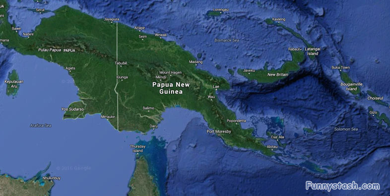
Papua New Guinea border with Indonesia

Aerial View of Papua New Guinea