Gps Coordinates / 22.314272,114.15884
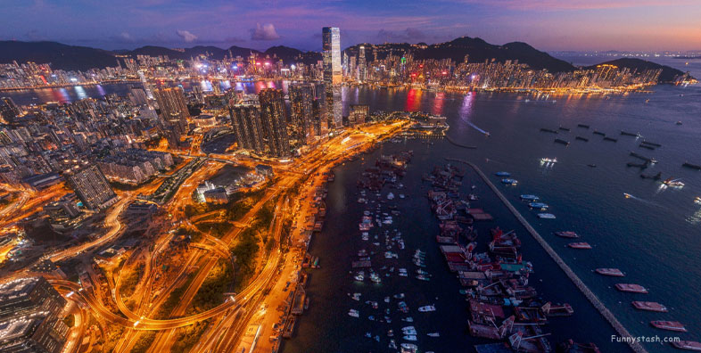
Hong Kong Skyline Drone Panorama 360 VR
New Yau Ma Tei Typhoon Shelter, Hong Kong
-
An Interesting view of Central Hong Kong from a Drone pictured in a stormy night and calm morning, the stormy night drone capture is a nice Panorama for the skyline above a picturesque football field lit up with lights surrounded by high rise accommodation, high speed rail and mountainous hills leading to highlands China, China may have risen but Hong Kong has always really been a lively hub of activity
Gps Coordinates / 22.315451,114.147188
Notice how the skyline changes from day to night as you pan around these panorama360s
Link Location Gps / Gps Link 22.307887 / Gps Link 22.33572 / Gps Link 22.322973
Gps Coordinates / 22.307887,114.164944 / 22.33572,114.101048 / 22.322973,114.193104
The Drone goes around the shoreline but also goes deep into the city nightlife of Hong Kong
Gps Coordinates / 22.312224,114.186768
Hong Kong is right on the edge of The Asian continent alot of people are unaware that most of Asia and large parts of China are deserts until you get nearer Tibet and the Xizang Autonomous Region which is why it's such a hotbed of political discussion, with many deserts closeby many wish claim of that watery mountain region. The wet shores of Asia show an illusion of how the mountainous regions of mainland can be.
Aerial view from above

