Gps Coordinates / 26.5512989,-82.6246756
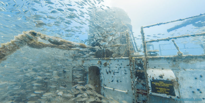
Sunken USS Mohawk
Gulf of Mexico 76RVH92G+G4
She was first assigned patrol and general icebreaking duties on the Hudson and Delaware Rivers, and the outbreak of war found her stationed at Cape May, New Jersey. In accordance with Executive Order No. 89-29 of 1 November 1941, Mohawk was directed to serve as part of the naval forces of the United States. Assigned to North Atlantic escort operations with the Greenland Patrol, where she served for the entire war, Mohawk launched a total of 14 attacks against submarine contacts between 27 August 1942 and 8 April 1945.
Gps Coordinates / 26.5512938,-82.6245321
The fifth US Coast Guard cutter named Mohawk (WPG-78) was built by Pusey & Jones Corp., Wilmington, Delaware, and launched 1 October 1934. She was commissioned on 19 January 1935
Link Gps Locations / Link Gps -82.6246447 / Link Gps -82.6248689 / Link Gps -82.6247954
Gps Coordinates / 26.5512611,-82.6246447 / 26.5512591,-82.6248689 / 26.5512904,-82.6247954
On the evening of 27 August 1942 the fleet oiler USS Laramie was torpedoed while steaming in convoy at the eastern end of Belle Isle Strait. Mohawk escorted Laramie into port at Sydney, Nova Scotia on 30 August 1942
Link Gps Locations / Link Gps -82.6245606 / Link Gps -82.6244998 / Link Gps -82.6244558
Gps Coordinates / 26.5512612,-82.6245606 / 26.5512605,-82.6244998 / 26.5512606,-82.6244558
One of Mohawk's most famous deeds was being the last ship to radio General Dwight D. Eisenhower on the day before the Normandy invasion, confirming that the weather was going to be clear enough to proceed. Unfortunately, she hit an iceberg shortly after the message was sent and sustained a hole in her side. After a temporary fix in Greenland, she returned to the United States for permanent repairs to the hull.
Link Gps Locations / Link Gps -82.624472 / Link Gps -82.624376 / Link Gps -82.624319
Gps Coordinates / 26.551299,-82.624472 / 26.551287,-82.624376 / 26.55125,-82.624319
Mohawk also survived a friendly fire attack from British planes. While on patrol near Iceland, she was misidentified by British planes, which bombed her, damaging the main deck. She returned to Boston for emergency repairs.
Gps Coordinates / 26.5512163,-82.624674
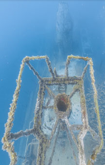
In 2012, the museum was reluctantly forced to either scrap Mohawk or sink her as an artificial reef due to a lack of funds necessary to recover her from her state of disrepair. It was ultimately decided that the most honorable fate was to give her a final duty serving as a veteran's memorial reef in lieu of the scrap yard, where she would have been melted down and sold.
Starting May 16, 2012, "Mighty MO" was in port at Fort Myers Beach, FL, to be cleaned and getting ready to be scuttled 28 nautical miles off the coast of Captiva Island in its final service as a Veteran's Memorial artificial reef. She was sunk on July 2, 2012.
Click below or above for directions
