Gps Coordinates / 19.3206161,-155.0395847
Volcano Kamokuna Ocean 360 Spheres
8XC6+65V Kalapana, Hawaii, USA
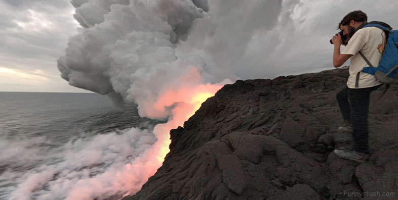
For nearly 16 months beginning on July 26, 2016, lava travelled through an evolving lava-tube network into the ocean at Kamokuna. Lava alternately built new land into the ocean when the steep submarine slope grew sufficiently seaward to support a lava delta and poured directly into the ocean as a great lava fall when the delta and submarine slope collapsed, shearing the tube at the sea cliff and exposing a lava stream 1 to 2 m (3 to 6 ft) in diameter gushing into the ocean.
Link Location Gps -155.0395572
Gps Coordinates / 19.3207251,-155.0395572
Earlier this year, with commercial boat operators taking people to the lava entry by sea, thousands of people viewing the lava fall from the established viewing area inside Hawai‘i Volcanoes National Park or by helicopter, more people probably witnessed this lava fall than any other since lava first reached the ocean in 198
Link Location Gps -155.0425977
Gps Coordinates / 19.3210835,-155.0425977
If the east tube continues to capture more of the lava stream from the west tube and more voluminous breakouts spread eastward, they could eventually travel towards the coast along steepest-descent paths east of the current 61g flow. Stay tuned to the flow’s next move by visiting the HVO website for updated thermal maps, updates, and photographs of the flow field.
Link Location Gps -155.0954502
Gps Coordinates / 19.2957916,-155.0954502
First, many scattered breakouts from the lava-tube network between Pu‘u ‘Ō‘ō and the delta effectively decreased the amount of lava reaching the coast. A series of breakouts from the upper section of tube this past summer developed into a second tube on the east side of the 61g flow, diverting an increasing volume of lava from the primary (west) tube and ultimately, the delta.
