Gps Coordinates / 20.0258449,75.1776769
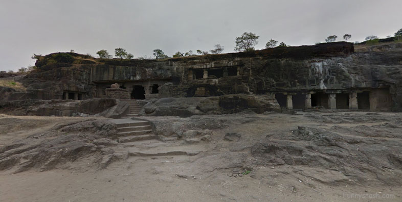
Ellora Caves 6th Century India
25GH+83M Verul, Maharashtra, India
Ellora is a UNESCO World Heritage Site located in the Aurangabad district of Maharashtra, India.
Gps Coordinates / 20.0258725,75.1776936
It is one of the largest rock-cut Hindu temple cave complexes in the world, featuring Hinduism, in particular a few Buddhist and Jain monuments with Artwork dating from the 600–1000 CE period.
Gps Link Gps Location / Link Gps 20.025904 / Link Gps 20.0259121 / Link Gps 20.0260373
Gps Coordinates / 20.025904,75.1777867 / 20.0259121,75.1778151 / 20.0260373,75.177921
Cave 16 features the largest single monolithic rock excavation in the world, the Kailash temple, a chariot shaped monument dedicated to Lord Shiva. The Kailash temple excavation also features sculptures depicting the gods, goddesses found in Hinduism as well as relief panels summarizing the two major Hindu Epics.
Gps Link Gps Location / Link Gps 20.0257589 / Link Gps 20.0258711 / Link Gps 20.0254336
Gps Coordinates / 20.0257589,75.1790444 / 20.0258711,75.1779689 / 20.0254336,75.1781092
There are over 100 caves at the site, all excavated from the basalt cliffs in the Charanandri Hills, 34 of which are open to the public. These consist of 17 Hindu (caves 13–29), 12 Buddhist (caves 1–12) and 5 Jain (caves 30–34) caves. Each group represents deities and mythologies prevalent in the 1st millennium CE, as well as monasteries of each respective religion.
Gps Link Gps Location / Link Gps 20.0259324 / Link Gps 20.0263239 / Link Gps 20.0263612
Gps Coordinates / 20.0259324,75.1777051 / 20.0263239,75.1775435 / 20.0263612,75.1776476
They were built close to one another and illustrate the religious harmony that existed in ancient India. All of the Ellora monuments were built during the Rashtrakuta dynasty, which constructed part of the Hindu and Buddhist caves, and the Yadava dynasty, which constructed a number of the Jain caves. Funding for the construction of the monuments was provided by royals, traders and the wealthy of the region.
Gps Link Gps Location / Link Gps 20.0265794 / Link Gps 20.0265444 / Link Gps 20.0271079
Gps Coordinates / 20.0265794,75.1774207 / 20.0265444,75.1774334 / 20.0271079,75.1773016
Although the caves served as temples and a rest stop for pilgrims, the site's location on an ancient South Asian trade route also made it an important commercial centre in the Deccan region. It is 18 miles north-west of Aurangabad, and about 190 miles east-northeast of Mumbai. Today, the Ellora Caves, along with the nearby Ajanta Caves, are a major tourist attraction in the Marathwada region of Maharashtra and a protected monument under the Archaeological Survey of India [ASI].
Gps Coordinates / 20.0265785,75.1773467

