Gps Coordinates / 40.7485406,14.4846713
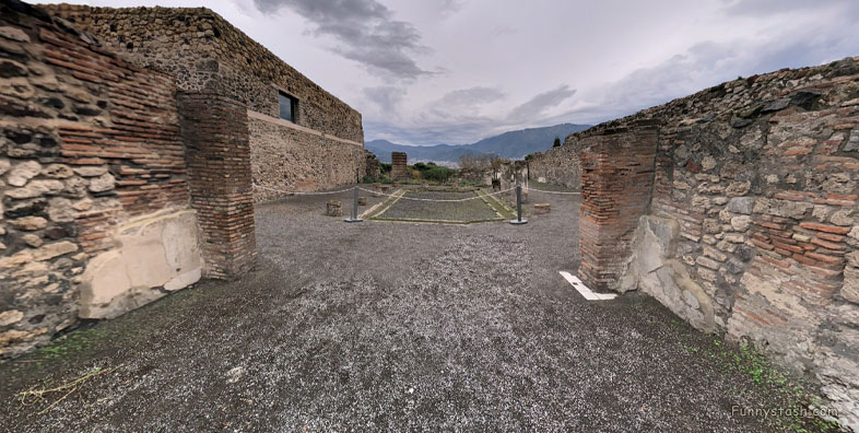
Pompei Roman Ruins VR Archeology Municipal Buildings Comitium
Vicolo di Championnet, 80045 Pompei NA, Italy
Built during the 2nd century BC, it originally constituted the headquarters of the polling station and then became the place intended for the counting of votes and the announcement of newly elected judges (Diribitorium), whereas the square of the Forum became an area for casting the votes.
Date of excavation:- 1814 - 1826
Gps Coordinates / 40.748766,14.4853844
All overlook a portico that connects them to the Comitium and the Basilica, thereby constituting a group of buildings linked to civilian city life.
Link Location Gps / Gps Link 40.748769 / Gps Link 40.7486931 / Gps Link 40.7485133
Gps Coordinates / 40.748769,14.484914 / 40.7486931,14.4851728 / 40.7485133,14.4848533
Diribitorium in Ancient Rome, whereas the square of the Forum became an area for casting the votes.
The Comitium is located in the southeast corner of the square of the Forum.
Link Location Gps / Gps Link 40.7488477 / Gps Link 40.7488182 / Gps Link 40.7487892
Gps Coordinates / 40.7488477,14.4852776 / 40.7488182,14.4851644 / 40.7487892,14.4849419
The importance of this building for local political life is also indicated by the many electoral campaign posters that covered the pillars of the entrance on Via dell’Abbondanza and the suggestum on the south side.
There are 3 public administration buildings on the south side of the square, one after the other, from west to east.
Gps Coordinates / 40.7487511,14.4849659
The Tabularium, a store with a gap that isolates it from the neighbouring buildings to avoid the risk of fire, the Curia, that is the Council meeting-house, with space to accommodate the benches used during meetings with the Building of the Duoviri, the magistrates who governed the city.
-
Get your Pompei tour tickets from official vendors
-
https://www.pompeionline.net/en/
-
https://www.pompeiitourguide.com/
-
https://www.pompeii-tickets.com/
-
https://www.pompeitickets.com/
-
-
