Gps Coordinates / 9.0851239,123.2721202
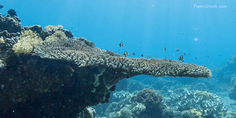
Apo Island Reef Philippines
37PC+2RX Dauin, Negros Oriental, Philippines
The Bohol Sea, also called the Mindanao Sea, is located between Visayas and Mindanao in the Philippines, a chain of islands just off from the main island Negros which is extremely difficult to get to
You can do a 360 tour of this large reef umbrella
Greater blueringed octopus, Wonderpus, Mimic octopus, Poison ocellate octopus, Ambon scorpionfishes, Flamboyant cuttlefishes, bluespotted stingrays, nudibranchs, and many species of frogfish
Gps Coordinates 9.085283, 123.272356
Scuba diving is a principle industry in Dauin. Several marine reserves and dive sites are situated along the coast. Apo Island, which is included in the territory of Dauin, is a 72-hectare volcanic outcrop several kilometers off the coast that attracts large numbers of scuba and snorkel enthusiasts.
Apo Island is part of the jurisdiction of the municipality of Dauin. The island is also a popular site for scuba diving. As it is completely surrounded by coral reefs, the whole island is a dive site.
Link Location Gps / Gps Link 9.0854049 / Gps Link 9.0852394 / Gps Link 9.0851903
Gps Coordinates / 9.0854049,123.2726519 / 9.0852394,123.2724144 / 9.0851903,123.2722782
Some of the province's most popular resorts are situated along Dauin's beaches. Most are focused on diving with regular excursions to Dauin's marine reserves and Apo Island.
