Gps Coordinates / 37.8252967,-122.4212955
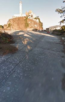
Alcatraz Parade Ground 2013 VR Alcatraz Island
RHGH+4F8 Fisherman's Wharf, San Francisco, CA, USA
1899 Upper Prison (Alcatraz's third prison) was built on the Parade Ground.
Parade ground seen the most military personnel applications of the history on alcatraz island leaves many unaware
Link Location Gps / Gps Link -122.4209596 / Gps Link -122.4218793 / Gps Link -122.420985
Gps Coordinates / 37.825825,-122.4209596 / 37.8257965,-122.4218793 / 37.825852,-122.420985
1849 onset of the California Gold Rush the following year, the U.S. Army began studying the suitability of Alcatraz Island for the positioning of coastal batteries to protect the approaches to San Francisco Bay.
Link Location Gps / Gps Link -122.4210082 / Gps Link -122.4210319 / Gps Link -122.4210576
Gps Coordinates / 37.8258776,-122.4210082 / 37.8259006,-122.4210319 / 37.8259233,-122.4210576
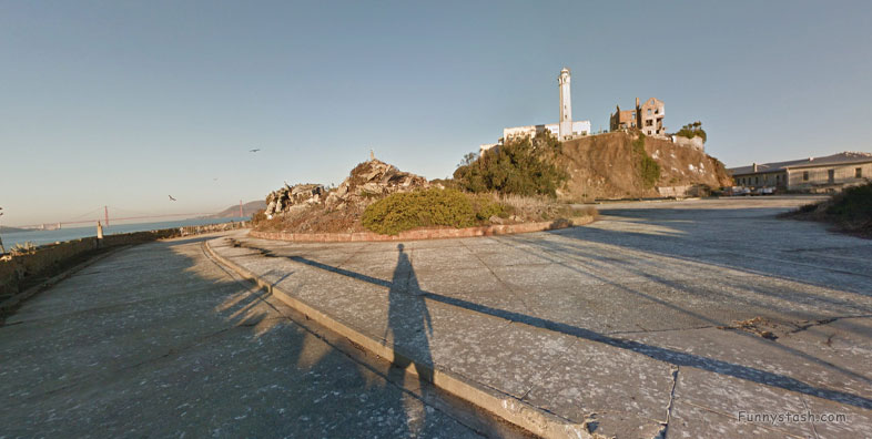
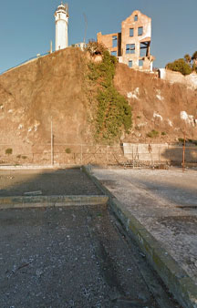
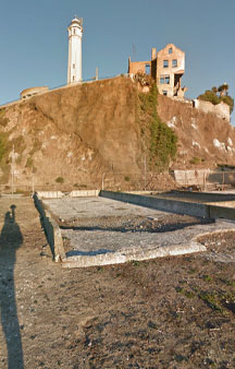
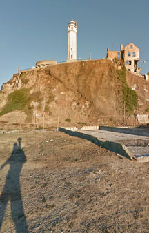
Alcatraz Parade Ground Promenade is a large concrete open area on the south end of Alcatraz Island, off the coast of San Francisco, USA.
Link Location Gps / Gps Link -122.421082 / Gps Link -122.4211087 / Gps Link -000.000
Gps Coordinates / 37.8259447,-122.421082 / 37.8259682,-122.4211087 / 37.8259918,-122.4211378
During the Civil War-era, rapid changes in artillery and fortification were generated.
Link Location Gps / Gps Link -122.4211648 / Gps Link -122.4211886 / Gps Link -122.4212073
Gps Coordinates / 37.8260142,-122.4211648 / 37.8260361,-122.4211886 / 37.8260561,-122.4212073
Alcatraz's defenses were obsolete by the postwar years.
Link Location Gps / Gps Link -122.4212248 / Gps Link -122.4212456 / Gps Link -122.4212709
Gps Coordinates / 37.8260757,-122.4212248 / 37.8260994,-122.4212456 / 37.8261246,-122.4212709
Modernization efforts, including an ambitious plan to level the entire island and construct shell-proof underground magazines and tunnels, were undertaken.
Link Location Gps / Gps Link -122.4212974 / Gps Link -122.4213209 / Gps Link -122.4213408
Gps Coordinates / 37.8261483,-122.4212974 / 37.8261715,-122.4213209 / 37.826196,-122.4213408
Between 1870 and 1876 but never completed (the so-called "parade ground" on the southern tip of the island represents the extent of the flattening effort).
Link Location Gps / Gps Link -122.4213624 / Gps Link -122.4213851 / Gps Link -122.4214079
Gps Coordinates / 37.8262171,-122.4213624 / 37.8262375,-122.4213851 / 37.8262572,-122.4214079
Instead, the army switched the focus of its plans for Alcatraz from coastal defense to detention, a task for which it was well suited because of its isolation.
Link Location Gps / Gps Link -122.4214287 / Gps Link -122.4215075 / Gps Link -122.4215159
Gps Coordinates / 37.8262739,-122.4214287 / 37.8262655,-122.4215075 / 37.826243,-122.4215159
Parade Ground flatened due to those efforts now seems like a great future tourist spot to sit and eat a picnic however eating is only allowed in the designated area by the dock.
Link Location Gps / Gps Link -122.421525 / Gps Link -122.4215366 / Gps Link -122.4215518
Gps Coordinates / 37.8262177,-122.421525 / 37.8261936,-122.4215366 / 37.8261678,-122.4215518
The earliest recorded private owner of the island of Alcatraz was Julian Workman.
Link Location Gps / Gps Link -122.4215627 / Gps Link -122.4215669 / Gps Link -122.4215696
Gps Coordinates / 37.8261403,-122.4215627 / 37.8261134,-122.4215669 / 37.8260861,-122.4215696
Julian Workman to whom it was given by Mexican governor Pio Pico in June 1846, with the understanding that Workman would build a lighthouse on it.
Link Location Gps / Gps Link -122.4215693 / Gps Link -122.4215713 / Gps Link -122.4215764
Gps Coordinates / 37.8260602,-122.4215693 / 37.8260316,-122.4215713 / 37.826002,-122.4215764
Flattest part of Alcatraz being the parade ground had military interest with military applications.
Link Location Gps / Gps Link -122.4215868 / Gps Link -122.4215897 / Gps Link -122.4215906
Gps Coordinates / 37.8259767,-122.4215868 / 37.8259508,-122.4215897 / 37.8259243,-122.4215906
Fremont bought the island for $5,000 in the name of the United States government from Francis Temple.
Link Location Gps / Gps Link -122.4215998 / Gps Link -122.4216152 / Gps Link -122.421635
Gps Coordinates / 37.8258994,-122.4215998 / 37.8258775,-122.4216152 / 37.8258542,-122.421635
1850, President Millard Fillmore ordered that Alcatraz Island be set aside specifically as a United States military reservation.
Link Location Gps / Gps Link -122.4216573 / Gps Link -122.4217026 / Gps Link -122.4217381
Gps Coordinates / 37.8258387,-122.4216573 / 37.8258265,-122.4217026 / 37.8258221,-122.4217381
1853, under the direction of Zealous B. Tower, the United States Army Corps of Engineers began fortifying the island, work which continued until 1858, when the initial version of Fort Alcatraz was complete.
Link Location Gps / Gps Link -122.4217744 / Gps Link -122.4218085 / Gps Link -122.4218413
Gps Coordinates / 37.8258188,-122.4217744 / 37.8258144,-122.4218085 / 37.8258076,-122.4218413
Parade island's first garrison, numbering about 200 soldiers, arrived at the end of that year.
Link Location Gps / Gps Link -122.4218793 / Gps Link -122.4219193 / Gps Link -122.4219603
Gps Coordinates / 37.8257965,-122.4218793 / 37.8257837,-122.4219193 / 37.8257753,-122.4219603
When the American Civil War broke out in 1861, the island mounted 85 cannons old photographs of the cannon parade exist.
Link Location Gps / Gps Link -122.4219958 / Gps Link -122.4220305 / Gps Link -122.4220683
Gps Coordinates / 37.825762,-122.4219958 / 37.8257498,-122.4220305 / 37.8257455,-122.4220683
Used for military purposes based upon the U.S. acquisition of California from Mexico following the Mexican - American War.
Link Location Gps / Gps Link -122.4221045 / Gps Link -122.422135 / Gps Link -122.4221605
Gps Coordinates / 37.8257365,-122.4221045 / 37.8257223,-122.422135 / 37.8257023,-122.4221605
Fremont had expected a large compensation for his initiative in purchasing and securing Alcatraz Island for the U.S. government.
Link Location Gps / Gps Link -122.4221835 / Gps Link -122.4222046 / Gps Link -122.422222
Gps Coordinates / 37.8256789,-122.4221835 / 37.8256546,-122.4222046 / 37.8256308,-122.422222
U.S. government later invalidated the sale and paid Fremont nothing.
Link Location Gps / Gps Link -122.422231 / Gps Link -122.4222372 / Gps Link -122.4222345
Gps Coordinates / 37.8256032,-122.422231 / 37.8255772,-122.4222372 / 37.8255541,-122.4222345
Fremont and his heirs sued for compensation during protracted but unsuccessful legal battles that extended into the 1890s.
Link Location Gps / Gps Link -122.4222106 / Gps Link -122.422186 / Gps Link -122.422159
Gps Coordinates / 37.8255335,-122.4222106 / 37.8255133,-122.422186 / 37.8254956,-122.422159
The Parade Grounds are an open area on the south end of Alcatraz that host surprisingly few parades.
Link Location Gps / Gps Link -122.4221326 / Gps Link -122.4221054 / Gps Link -122.4220758
Gps Coordinates / 37.8254792,-122.4221326 / 37.8254635,-122.4221054 / 37.8254472,-122.4220758
It's an excellent spot for a selfie with an awesome view of the skyline of San Francisco.
Link Location Gps / Gps Link -122.4220456 / Gps Link -122.4220193 / Gps Link -122.4219979
Gps Coordinates / 37.8254326,-122.4220456 / 37.8254168,-122.4220193 / 37.8253978,-122.4219979
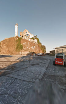
Turn around, and you have the lighthouse and warden's residence for a backdrop.
Link Location Gps / Gps Link -122.4219655 / Gps Link -122.421934 / Gps Link -122.4219022
Gps Coordinates / 37.8253785,-122.4219655 / 37.8253593,-122.421934 / 37.8253408,-122.4219022
Originally built in the 1860s by the US military for drills and marching, the space later became housing for the correctional officers and their families as well as a playground for their children after the island became a penitentiary.
Link Location Gps / Gps Link -122.4218694 / Gps Link -122.4218337 / Gps Link -122.4217986
Gps Coordinates / 37.8253232,-122.4218694 / 37.8253093,-122.4218337 / 37.8252952,-122.4217986
The Parade Grounds were also used for hosting special Officer's Club events.
Link Location Gps / Gps Link -122.4217647 / Gps Link -122.4217308 / Gps Link -122.4216947
Gps Coordinates / 37.8252816,-122.4217647 / 37.8252698,-122.4217308 / 37.825264,-122.4216947
The children living in the quarters on the Parade Ground were known to other children and their families on Alcatraz as "the topside kids" because they lived above those residing in Building 64 on the dock below.
Link Location Gps / Gps Link -122.4216579 / Gps Link -122.4216196 / Gps Link -122.4215814
Gps Coordinates / 37.8252583,-122.4216579 / 37.8252559,-122.4216196 / 37.8252553,-122.4215814
Today the grounds host annual sunrise ceremonies which celebrate Native American culture and commemorate the 2-year occupation by the Indians of All Tribes.
Link Location Gps / Gps Link -122.4215447 / Gps Link -122.4215094 / Gps Link -122.4214746
Gps Coordinates / 37.8252585,-122.4215447 / 37.8252625,-122.4215094 / 37.8252712,-122.4214746
The island ceased use as a jail in 1963 and the residential buildings and gardens which were added were razed to the ground by the General Services Administration in the 1970s, but the foundation marks can still be seen.
Link Location Gps / Gps Link -122.4214415 / Gps Link -122.4214057 / Gps Link -122.4213687
Gps Coordinates / 37.8252795,-122.4214415 / 37.8252869,-122.4214057 / 37.825286,-122.4213687
After the island became a Federal Penitentiary in 1934, the Parade Grounds was used as a playground, especially on weekends and holidays, and was used host special events, often organized by the Officer's Club.
Link Location Gps / Gps Link -122.4213326 / Gps Link -122.4212612 / Gps Link -122.4212263
Gps Coordinates / 37.8252871,-122.4213326 / 37.8253092,-122.4212612 / 37.8253218,-122.4212263
The parade ground is the trailhead for the Alcatraz Agave Trail and is open when the birds are not nesting, from about mid October to mid January.
Link Location Gps / Gps Link -122.4211893 / Gps Link -122.4211546 / Gps Link -122.4211237
Gps Coordinates / 37.8253355,-122.4211893 / 37.8253486,-122.4211546 / 37.8253635,-122.4211237
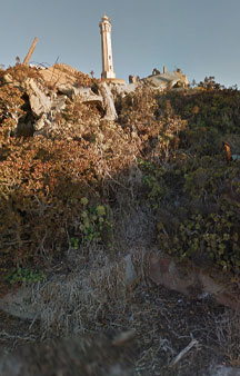
The parade grounds. Carved from the hillside during the late 19th century and covered with rubble since the government demolished guard housing in 1971.
Link Location Gps / Gps Link -122.421094 / Gps Link -122.4210618 / Gps Link -122.4210316
Gps Coordinates / 37.8253787,-122.421094 / 37.8253922,-122.4210618 / 37.8254069,-122.4210316
The area has become a habitat and breeding ground for black-crowned night herons, western gulls, slender salamanders, and deer mice.
Link Location Gps / Gps Link -122.4210014 / Gps Link -122.4209731 / Gps Link -122.4209471
Gps Coordinates / 37.8254227,-122.4210014 / 37.8254408,-122.4209731 / 37.8254622,-122.4209471
The Agave Trail makes its way around the outskirts of the Parade Ground offering stunning views from the East Bay to the Golden Gate Bridge.
Link Location Gps / Gps Link -122.4209195 / Gps Link -122.4208956 / Gps Link -122.4208712
Gps Coordinates / 37.8254845,-122.4209195 / 37.8255077,-122.4208956 / 37.8255296,-122.4208712
The Agave Path, a trail named for its dense growth of agave. Located atop a shoreline bulkhead on the south side, it provides a nesting habitat for night herons.
Link Location Gps / Gps Link -122.4208494 / Gps Link -122.4208276 / Gps Link -122.4208081
Gps Coordinates / 37.8255492,-122.4208494 / 37.8255688,-122.4208276 / 37.8255886,-122.4208081
Remember that seasonal weather and tidal closures of the path are currently in place.
Link Location Gps / Gps Link -122.4207902 / Gps Link -122.4207841 / Gps Link -122.4208037
Gps Coordinates / 37.8256092,-122.4207902 / 37.8256303,-122.4207841 / 37.82565,-122.4208037
As the nearby Building 64 aged and fell into disrepair, the operators of the prison funded several new residential blocks on the square.
Link Location Gps / Gps Link -122.4208254 / Gps Link -122.420837 / Gps Link -122.4208517
Gps Coordinates / 37.8256701,-122.4208254 / 37.8256964,-122.420837 / 37.8257205,-122.4208517
Gardens were developed around them, and handball and weightlifting facilities developed for the employees and their families.
Link Location Gps / Gps Link -122.4208695 / Gps Link -122.420887 / Gps Link -000.000
Gps Coordinates / 37.8257419,-122.4208695 / 37.8257613,-122.420887 / 37.8257842,-122.420911
-
We left some touring brochures below let us know how you got along.
.
Freetoursbyfoot.com/alcatraz-tours/
.
Alcatrazislandtickets.com/Alcatraz-Island-Tours/
.
Thetourguy.com/travel-blog/usa/san-francisco/alcatraz/how-to-visit-alcatraz-island/
.
Alcatraztoursf.com/san-francisco/city-tour
