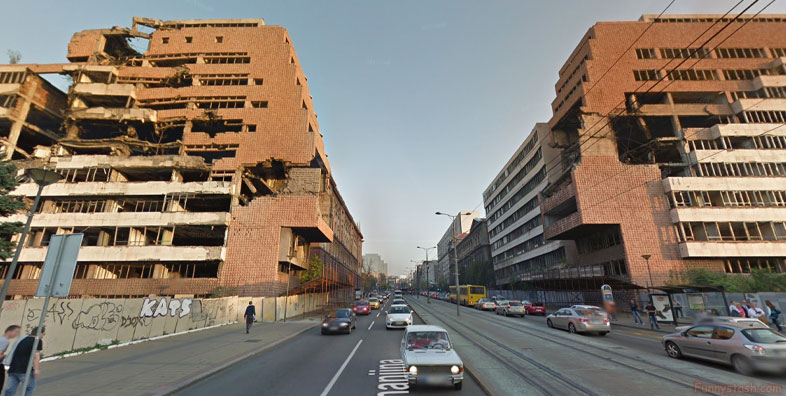
Location Direction Coordinates / 44.8058862,20.4601528
Serbia Nato Bombing 1999 Crime n Crazy VR Address
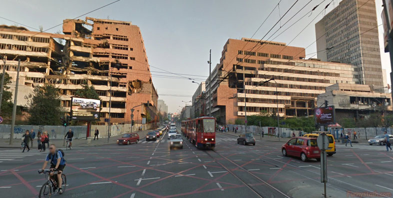
Nemanjina, Beograd, Serbia
The NATO bombing of the Radio Television of Serbia headquarters occurred on the evening of 23 April 1999, during Operation Allied Force.
Gps Coordinates / 44.8110038,20.4702052
The bombing was part of NATO's aerial campaign against the Federal Republic of Yugoslavia, and severely damaged the Belgrade headquarters of Radio Television of Serbia (RTS). Other radio and electrical installations throughout the country were also attacked. Sixteen employees of RTS were killed when a single NATO missile hit the building. Many were trapped for days, only communicating over mobile phones. The station returned to the air less than 24 hours later from a secret location. The building of the Russian church nearby was also seriously damaged.
Link Location Directions Gps 44.8058862
Gps Location Direction Coordinates / 44.8058862,20.4601528
The NATO bombing of Yugoslavia was the North Atlantic Treaty Organisation's (NATO) military operation against the Federal Republic of Yugoslavia during the Kosovo War. The air strikes lasted from March 24, 1999 to June 10, 1999. The bombings continued until an agreement was reached that led to the withdrawal of Yugoslav armed forces from Kosovo, and the establishment of the United Nations Interim Administration Mission in Kosovo, a UN peacekeeping mission in Kosovo. The official NATO operation code name was "Operation Allied Force" whereas the United States called it "Operation Noble Anvil"; in Yugoslavia the operation was incorrectly called "Merciful Angel" (Serbian: Милосрдни анђео / Milosrdni anđeo) as a result of a misunderstanding or mistranslation.
