Gps Coordinates / 33.2541112,-115.4728215
Salvation Mountain Slab City USA Slum VR Link Locations
Beal Rd, Calipatria, CA 92233, United States
The Folk Art Society of America declared it "a folk art site worthy of preservation and protection" in the year 2000. In an address to the United States Congress on May 15, 2002, California Senator Barbara Boxer described it as "a unique and visionary sculpture, a national treasure, profoundly strange and beautifully accessible, and worthy of the international acclaim it receives".
Link Location Gps -115.4738716
Gps Coordinates / 33.2545875,-115.4738716
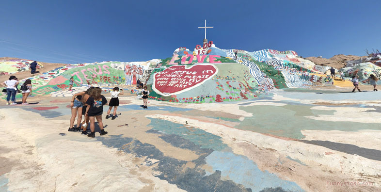
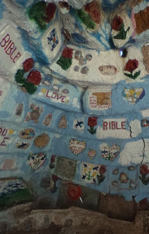
The artwork is made of adobe bricks, discarded tires and windows, automobile parts and thousands of gallons of paint. It encompasses numerous murals and areas painted with Christian sayings and Bible verses, though its philosophy was built around the Sinner's Prayer.
Link Location Gps / Gps Link -115.4728491 / Gps Link -115.4732418 / Gps Link -115.4724341
Gps Coordinates / 33.2540927,-115.4728491 / 33.2540246,-115.4732418 / 33.2539472,-115.4724341
The artwork is made of adobe bricks, discarded tires and windows, automobile parts and thousands of gallons of paint. It encompasses numerous murals and areas painted with Christian sayings and Bible verses, though its philosophy was built around the Sinner's Prayer.
Link Location Gps -115.4806232
Gps Coordinates / 33.2477498,-115.4806232
In December 2011, the 80-year-old creator Leonard Knight was placed in a long-term care facility in El Cajon for dementia. Leonard Knight died on February 10, 2014, in El Cajon. He was able to visit Salvation Mountain for the last time in May 2013, the visit was recorded by KPBS (TV).
Link Location Gps / Gps Link -115.4723345 / Gps Link -115.4724276 / Gps Link -115.4727552
Gps Coordinates / 33.2537972,-115.4723345 / 33.2539223,-115.4724276 / 33.2540139,-115.4727552
Salvation Mountain is a hillside visionary environment created by local resident Leonard Knight (1931–2014) in the California Desert area of Imperial County, north of Calipatria, northeast of Niland, near the Slab City squatter/art commune, and several miles from the Salton Sea.
Link Location Gps -115.4727965
Gps Coordinates / 33.2541456,-115.4727965
In 1998, Knight wanted to expand the mountain. He gathered ideas from the Navajo who settled in the area around Salvation Mountain. Their pueblitos inspired Knight and he then began forming the Hogan. It is a dome-like structure made of adobe and straw that insulates from heat.
Link Location Gps / Gps Link -115.472531 / Gps Link -115.4723032
Gps Coordinates / 33.2540298,-115.472531 / 33.2540452,-115.4723032
Knight was known for giving free tours to every visitor at Salvation Mountain. An article about Leonard Knight stated that he was a "visionary American folk artist" whose message was "unconditional love to humankind". Knight "arrived accidentally (but) immediately recognized an opportunity to continue his large-scale gospel message. He made a mountain with his bare hands. Leonard built Salvation Mountain".
Link Location Gps -115.4729569
Gps Coordinates / 33.2542212,-115.4729569
A National Geographic article published after Knight's death provided this insight into the creator of Salvation Mountain.
